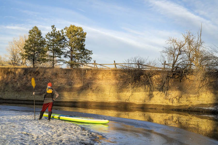
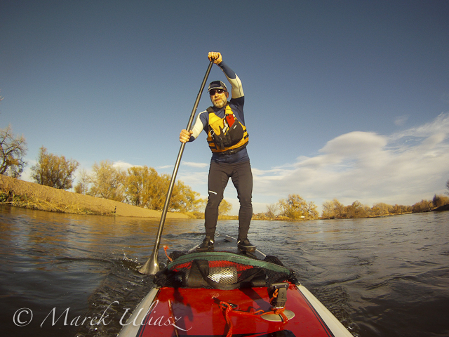
On February 17th, I began my 2023 river paddling season by taking my inflatable stand up paddleboard, the Voyager by Red Paddle Co, to the Poudre River in Fort Collins. The river flow in wintertime is close to zero, about 20 cfs, but you can find some water in the Poudre which will float you boat. Just look for backwaters of diversion dams: standing or slow moving water and very shallow. It’s not good for serious paddling, but it may be enough for some playing, shooting pictures or testing equipment.
I visited Poudre River section in Kingfisher Point Natural Area (access from Hoffman Mill Rd). In my old blog posts I may refer to this area as Nix or Nix Farm Natural Area. Depending on the river flow and operations of the diversion dam you may find there almost 1/4 of paddling water. If you are willing to do some dragging, you can even reach the Lemay street bridge at the upstream end.
The river is very shallow except very close to the dam. Therefore, you cannot use a regular long fin on your paddleboard. For recent 6 years, I’ve been using a retractable fin from Frogfish. I’ve found it on Amazon, but it doesn’t look to be available right now. Another solution is to use some sort of a flexible fin, like this one from saruSurf. You don’t really need a fin here, since you are paddling in circles anyway. However, the retractable fin is very useful for paddling down the South Platte River which is usually deep enough, but poses a high risk of hitting shallow areas or other underwater obstacles. So, if you are a SUP paddler be prepared for the joint paddling clubs trip on the South Platte, usually 3rd Saturday of March from Evans to Kersey or Kuner.
During my trip, I paddled more than 3 miles, going up and down the river and paddling in circles while shooting pictures and videos. I have some footage to edit and post on my Youtube channel. Please check my paddling playlist.
You can find another river spot like this in Fort Collins downtown at Legacy Park, but it’s more likely to be covered by ice in winter.
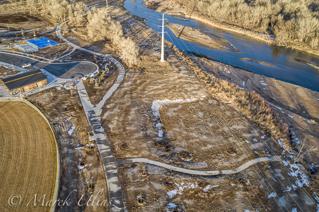
I haven’t paddled the South Platte since the last winter, so I decided to do some scouting around Greeley. There some changes …
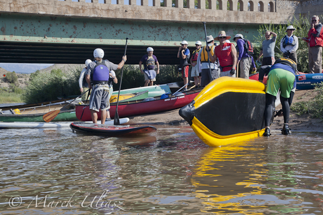
Riverside Park at Evans with a river access
Riverside Park at Evans
The park was rebuilt after flooding damages and reopened in October of 2018. The river access requires a longer walk than it used to be, but it is more comfortable. A concrete path leads directly to a huge sandbar. No more scrambling downhill through that concrete rubbish. The parking lot is accessible only from the 37th Street in Evans. You cannot drive around ball fields as before.
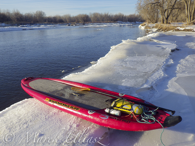
Kersey – county road 53
There is a construction of new bridge, so no parking along that road near the river. A little spot good for a couple of cars next to a water gage is still open. It looks like the main river channel is not obstructed, but I did not have a chance to check more carefully.
Update:Weld County Road 53 will be closed from March 25 until April 29. The new bridge is built, and the are down to connecting the new roadway to the old roadway and then demolishing the existing bridge. I am sure it will change the river access.
Kuner – county road 61
It looks the same.
Milliken – highway 60
Another bridge construction. It used to be a good parking spot there with a not easy but doable river access. It’s gone now! This was the end of my favorite “Wildcat Mound” river section with a start at the lower St Vrain Creek. Of course, you can paddle further downriver to Evans, but it would be 17 instead of 7 miles with 2 additional dam portages.
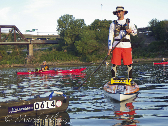
South Platte River at Evans looking downstream
Self shuttle
In the past, I did several river trips with a self shuttle using inline skates or bike to carry a packraft or towing a kayak. A traffic along, and, especially, across the river in Weld County has significantly increased during last a few years – a lot of farm and cistern tracks. It makes my self shuttling less attractive.
Wildlife rangers
In February of 2017 I had a long chat with a Weld County wildlife ranger under the Kuner bridge. I was lectured that I couldn’t legally access the river there, because the Kuner and Kersey bridges had no right off way and landowners could get upset. They also don’t allow to launch any boats from Mitani-Tokuyasu SWA above Kersey (I was using that spot 15 years or so). The ranger got some landowners complaints about trespassing, but none against paddlers. During my 20 years of paddling the South Platte I didn’t upset anybody except two wildlife rangers.
A few years ago, a friend wanted to train with a racing canoe on the South Platte during winter, So he called Colorado Parks and Wildlife Department. He heard the same story. Yes, you can paddle the river. No, you cannot legally access the river anywhere (Kersey was specifically mentioned). However, they didn’t mentioned, that there were several public riverside parks along the South Platte below Denver including Brighton, Fort Lupton, Evans or Fort Morgan. My impression is that they really represent interests of hunters and landowners. Paddling or recreational use of the river is just a nuisance.
I am still paddling the Horsetooth Reservoir this winter, but my first paddling on the South Platte will be the upstream/downstream workout starting at Evans Riverside Park. I am also checking water levels at St Vrain Creek.
January 3, 2016. First SUP paddle of the year with Rob Bean. We paddled 10 miles on the South Platte River from highway 58 to Kuner. Great weather, river flow ~900 cfs at Kersey, several bald eagles and hundreds of ducks. There are no portages on this river section since we started just below the Plumb Ditch Dam (the second diversion dam if you paddle from Evans).
We started from a gravel bar under the new bridge on highway 58 – a right river shore with parking on a wide shoulder, a shorter, steeper route with barbed wire fence on the upstream bridge site. Downstream bridge site may be more convenient without the fence, but with a little longer walk. You can reach the bridge by turning into the new highway 49 at traffic lights from Colorado highway 34 between Evans and Kersey.
Rob posted his pictures on facebook. They actually show much better our launching site.
I am paddling 10’6″ Badfish SUP during winter on the South Platte, typically, with a shorter 2″ NRS fin.
Start at gravel bar under the new highway 58 bridge
Somewhere on the river around Kersey
Ducks, ducks, and more ducks. Hundreds of them.
Finishing 10 mile trip at Kuner
A little bit icy landing at Kuner (left shore upstream of the bridge)
Confluence of two Grizzly Creeks 10 miles SW of Walden, CO – the beginning of the North Platte River
North Platte River is one of my favorite paddling destinations. Usually, I paddle various flatwater river sections in Wyoming above and below Saratoga. However, there is a 45 mile long river stretch in Colorado’s North Park before the North Platte enters the Northgate Canyon.
After some fall and winter scouting and a lot of time spent on Google maps, the exploration of the upper North Platte River finally took place during the Memorial Day weekend. Rob Bean joined me to paddle our inflatable Bordwarks SUPs: Shubu and Badfish.
Upper North Platte River on Google maps with some waypoints for access points and diversion dams.
14 miles of the upper North Platte River near Walden with the river beginning as a confluence of Grizzly Creek and Little Grizzly Creek
May 24, 2014 Put-in: Grizzly Creek at highway 14, 10 miles south of Walden (not much room for off road parking) Take-off: Co road 12 W, 8 miles west of Walden (official fishing access, parking near bridge, another fishing access with parking ~0.5 mile below the bridge).
GPS milege: 13.8 miles, time: 2:50 hours.
31 miles of the North Platte River from Walden to the Northgate Canyon put-in
May 25, 2014 Put-in: Co road 12 W Take-off: put-in for the Northgate Canyon run, 9 miles north of Cowdrey
Alternative put-in for a short 6 miles run: Co Rd 6, 2 miles west of Cowdrey (that run is described in Paddling Colorado book by Dunbar Hardy).
GPS milege: 31 miles, time: 6:49 hours.
River flow was rising from 3000 to 4000 cfs at Northgate during our two days of paddling. A lot of meadows in the river valley were flooded. Paddling speed: up to 9 mph.
The weather was challenging. We had a lot of thunderstorms around us during the first day followed by ~8 hours of heavy rain. We were lucky to finished our paddling before the rain. A beautiful weather on second day lasted till noon, then we experienced a storm with a small hail followed by heavy rain for the rest of the day. Strong afternoon headwinds put us on our knees, especially, during the second day.
Obstacles: diversion dams, fences across the river, low bridges depending a water level. No trees. No rapids (except dams). The river is wide and open, so you can see or hear all incoming obstacles well in advance. We never run into any troubles.
Most of the dams can be seen on satellite pictures. The dam a few miles below Co road 12 W is pretty big and always requires portaging (not comfortable on right). Other dams are primitive rock dams and often can be run. We portaged most of them to avoid big waves, but I would run more of them in a canoe. We managed to paddle around a few of them. It is easier to select a correct river arm on a map than in practice on the river.
We had to portage numerous barbed wire fences crossing the river. Some were in water and could be safely run over in a canoe, but we played safe in out inflatable SUPs. A few fences had only a single wire across the river and was possible to paddle under them. Always watch for these fences! You can notice stronger and taller posts on the shores and, sometimes, stairs over them, before seeing the actual wires over the river.
One or two low farm bridges in the upper section required portaging. All bridges in the lower section have a high clearance.
Wildlife: moose, bighorn, deer, elk (a herd was swimming across the river several times just in front of us), bald and gold eagles, pelicans, geese and other waterfowl, numerous smaller birds, curious cows.
Scenery: a wide valley surrounded by snowy mountains, crazy river meanders in the upper section, cliffs and rock outcroppings, just a few trees (often with eagle nest), higher hills with some forest in the lower section, a lot of water flowing around and flooding meadows, but, usually, not difficult to find a dry place to land.
Grizzly Creek looking upstream from highway 14
Grizzly Creek looking downstream from highway 14 – start of our adventure
North Platte River meandering near Walden
One of high cliffs
Going over a low farm bridge
One of diversion dams
North Platte River at Co Rd 12 W near Walden – the finish of day 1 and the start of day 2
Barbed wire fence across the river
Another fence across the river
And another cattle fence to portage
Lunch break – last minutes of nice weather
Hail storm over diversion dam
The last river section between Cowdrey and Northgate
Finishing in rain at the Northgate
The last look at the river – still raining
Ready to go home …
All pictures were shot with my current paddling camera on duty – Pentax Optio WG-2. I have been using waterproof Pentax Optio cameras for paddling and other outdoor activities since their first original model was released in 2005. The newest model from that series is available now as Ricoh WG-4.
November 3, 2012. Paddling Bark Expedition SUP on the South Platte River near Kersey, Colorado. Camera: GoPro Hero.
It was my first time with SUP on a river – a short, but intense upstream / downstream workout starting at the Kersey bridge. A nice weather and good river flow. You can find more picture from that paddling in Fitness Paddling blog.
I will be back on the South Platte with SUP or other boat. The winter paddling season is open.
August 19, 2012. Dotsero. Preparing for the start of the Colorado River Race in the upper Glenwood Canyon – 10 miles from Dotsero to Hanging Lake Trailhead. This annual race run by Jerry Nyre takes place on the 3rd Sunday of August. Camera: Pentax Optio WG2.
July 31, 2012. Shane Perrin on his stand up paddling board, 14-foot Pau Hana Crossfit, at the start of 7th Missouri River 340 Race. He finished the race in 66:41 hours (54th place overall), 2 minutes slower than his previous year run (66:39) despite of low water conditions. Camera: Pentax Optio WG2.
Since Wyoming Outback Challenge (annual 44 miles paddling race) is gone, we decided to make a longer training run on the North Platte River this year (May 22-23). We means me with Pixel, Rob Bean and two Kruger canoes.
On Friday, May 21 we run a shuttle between Seminoe State Park and Bennett Peak campground which we reached at sunset after a stop at Saratoga. Saturday was a full day of paddling starting around 7:00 am and stopping for a night 12+ hours later between Dugway and the Seminoe Reservoir. On Sunday, we paddled the last few miles of the river and then a lake to the North Red Hills campground and boat ramp. We finished paddling around 4 pm, took a look at the dam, drove to Saratoga for a dinner, and recovered our second car from the Bennett Peak campground at sunset. The Snowy Range road was still closed, so we returned to Fort Collins through Walden and Cameron Pass.
We experienced every possible weather Wyoming can offer: a very warm night and morning at the Bennett Peak campground, winter conditions (rain, snow, wind) during the second half of out first day, chilly night in tents covered by frost, sunny second day: calm and turning windy in the afternoon.
Wildlife: one moose, plenty of deer, proghorns, bald eagles, pelicans, and a lot of other birds.
I covered almost the entire course of our trip before, but in shorter separate segments paddled at different times. I didn’t paddle before the river from Dugway to the middle of the Seminoe Reservoir (Sand Mountain). I visited the Seminoe Reservoir only once years ago. It was in August of 2000 with my CLC Patuxent kayak: there is still a short report from that trip at Mountain Wayfarer. It looks really ancient …
GPS odometer: 114.5 miles, 16:58 hours of moving time, 3:34 stopping time (not counting our overnight camping), 6.7 mph average moving speed, 11.7 mph max speed.
River flow: 7000-8000 cfs at Dugway above Seminoe Reservoir, the reservoir was filled to 70% of full capacity.
The above slide show is a new setup created with Adobe Lightroom 2 and SlideShowPro. Recently, I am using Lightroom to manage all my pictures both paddling and stock images. I created slide shows with Lightroom before (see, e.g., Colorado River Race or Dismal River 2009). However, this time I used also SlideShowPro which adds more functionality. Please let me know how do you like it, and whether you had any problem watching it. I am going to post more slide shows in a similar format.
Most pictures were shot with waterproof Pentax Optio W30, a few with Canon 5D/II (camping), and Canon PowerShot G11 (the Seminoe Reservoir and Dam).
Rob posted his pictures from the trip on facebook.
I am extending my paddling on the North Platte River in southern Wyoming. Last Sunday I had a very nice trip from Bennett Peak campground to Pick Bridge below Saratoga. I paddled Sea Wind canoe with Pixel, the water corgi, as a partner. Connie with Dax were waiting for me at the Pick Bridge. It was a fast training run: 36 miles in exactly 4 hours without any stops.
River flow: ~1700 cfs in the North Platte at Northgate + ~1000 cfs from the Encampment River joining just above Treasure Island, ~4500 cfs in the North Platte further downstream. It was still high water, but much lower than a month ago during the Wyoming Outback Challenge. A perfect weather with just a moderate wind, very green with a lot flowers. A lot of wildlife including nesting bald eagles.
The river below the Bennett Peak campground is very scenic. It flows in a granite canyon with many rocks and cliffs. There are multiple narrower channels in several places. Paddling was easy. I suppose that it may be more challenging at lower water: some rocks sticking out and rocky shallows in some channels.
Driving to the Bennett Peak access takes some time. It can be reached by 19 mile long dirt road starting at highway 230 a few miles east of Riverside. The road is well marked and pretty scenic. The first 10 miles you can drive at highway speed, then you need to slow down.
I started to paddle at 11am. The light was very harsh and not so pleasant for photography. Nevertheless, I shot a few pictures with Pentax Optio W30 camera between the Bennett Peak and Treasure Island for documentary reasons.