Oct


I started my exploration of the lower St Vrain Creek in spring of 2004. I covered 7 miles of the river from highway 66 to the South Platte near Platteville. Most often, I launch at the Weld county road 19.5 just north of the Fort St. Vrain Power Station and a mile above the confluence. The best flow to paddle there is perhaps around 400 cfs, but there is still enough water to paddle at 100 cfs, especially, if you are just going downriver. You may encounter occasional log jam and one rocky and shallow spot near a high cliff before you reached the South Platte. There is a diversion dam with an easy portage about 1.5 mile above the county road 19.5.

Paddling the St Vrain above the lowest 7 miles may be a little bit more problematic and challenging. A few years ago Mark Zen sent the following comments:
My family and I have paddled the St Vrain from near Hygiene all the way to the confluence with the Platte. There are a few stretches you want to avoid – from 119 to Barbour Ponds (St Vrain State Park) We would take out at 119, and then put back in on the I-25 frontage road. You have to get back out near WCR 17, near a gravel quarry… We finally stopped doing that part of the river, due to the large number of portages, due to barbed wire across the river in many places. 8 portages??
That is a similar reason we only paddle the Platte from Brighton to Ft Lupton, as some of the portages between Ft Lupton and Platteville are horrible. If there is enough water, the Adams County Fairgrounds all the way to Ft Lupton is a nice full day. There is one really bad portage near the dam on the Fairgrounds to Brighton piece. Just because you come around a blind corner.

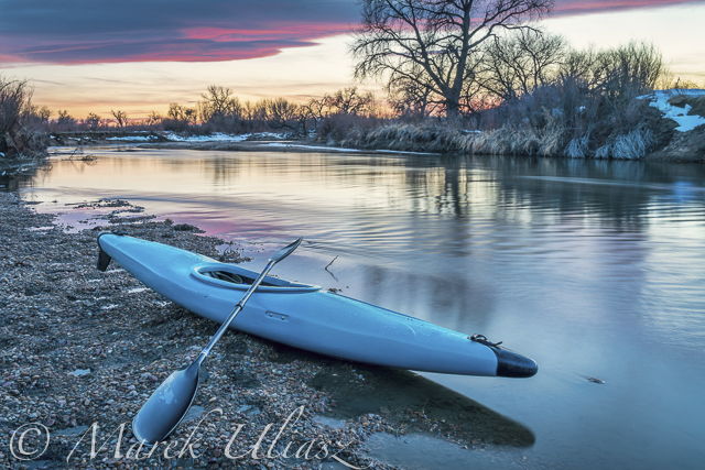
Pictures in this post come from my recent early October paddling on the St Vrain Creek. I was testing my low water paddling rig: old Seda Cyclon whitewater kayak with an added fin and a heavy duty wildwater wing paddle. The kayak was tracking pretty well and I enjoyed upstream/downstream workout. I had enough room to pack a tripod and my Canon DSLR camera.


The last two pictures are HDR (high dynamic range) images obtained by combining multiple frames shot with different exposure (4 frames above and 2 below) in Photomatix software.
Evening Blue Hour

I finished my paddling at sunset and I was ready to shoot the nearby power station during evening blue hour. Evening Blue Hour refers to the period of twilight when there is neither full daylight nor complete darkness. It is the best time to photograph cityscape or industrial scenery with a lot of lights against the deep blue sky. The blue hour starts approximately 15 minutes after sunset and is lasting only 10 minutes, so it is really a short time window.
 I see a few way to improve my picture of the power plant. Cold temperatures can add drama by making steam plumes from cooling towers visible. Some snow cover on the foreground wouldn’t hurt either. Finally, water reflections would be cool. The power plant is nicely visible from the diversion dam upstream (see a thumbnail of my 2004 picture). So, it looks like I have a plan for a winter night paddling …
Fort St. Vrain Power Station was Colorado’s only Nuclear Power Plant and America’s only commercial High Temperature Gas Cooled reactor design. It was also the first commercial nuclear generating plant in the United States to be decommissioned. Currently, it operates combustion turbines burning natural gas.

Related posts:
Kayaking on Saint Vrain and South Platte Rivers near Platteville
2009 South Platte River Marathon/
South Platte River below Denver, Colorado – GPS/photo river guide
Related
Categories
Recent Posts
 Boyd Lake at dusk: bike and canoe adventureBy Marek on March 21, 2024
 Florida to Colorado with 4Runner and Liteboat Rowing ShellBy Marek on December 7, 2023
 Summer paddling, swimming and photography on Horsetooth ReservoirBy Marek on September 18, 2023


